
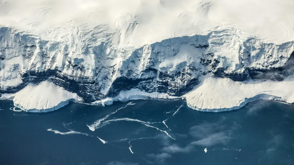
For decades, climate scientists have wrestled with a compelling mystery: how did Antarctica, a continent once lush and temperate, transform into a frozen wasteland while the rest of the planet remained significantly warmer? The prevailing consensus long held that atmospheric carbon dioxide levels were the primary driver of the Earth’s shift into the deep freeze. However, new research published in the journal Science suggests that the key to Antarctica’s icy transformation lies not in the sky, but deep beneath our feet.
An international team of researchers, led by the University of Southampton, has unveiled evidence that the geological uplift of East Antarctica—driven by mysterious, slow-moving "mantle waves"—was the essential precursor that allowed ice to gain a permanent foothold. This study fundamentally shifts our understanding of climate history, suggesting that the internal mechanics of the Earth "precondition" the planet for major glaciations.
The Mystery of the Early Freeze
Approximately 34 million years ago, as the Eocene epoch gave way to the Oligocene, the world underwent a dramatic climatic shift. While the global climate was still roughly 5°C warmer than today, East Antarctica began its transition into a permanent ice-covered state.
This presents a paradox for climatologists. If CO2 levels were the sole arbiter of glaciation, one would expect the Earth’s poles to react symmetrically. Yet, the Arctic remained largely ice-free for tens of millions of years longer than its southern counterpart, with significant Northern Hemisphere ice sheets not emerging until roughly five million years ago. The study posits that Antarctica gained a "major head start" not because of the atmosphere, but because its land surface was physically raised to a critical altitude.
A Chronology of a Frozen Continent
To reconstruct the evolution of the Antarctic landscape, the research team utilized sophisticated computational models to simulate 100 million years of geological change. The timeline of this transformation is as follows:
- 201–143 Million Years Ago (The Jurassic): Following the breakup of the supercontinent Gondwana, Antarctica began its long separation from Africa. This tectonic movement initiated deep-seated geological processes within the Earth’s mantle.
- 100 Million Years Ago to 45 Million Years Ago: Powerful, slow-moving pulses of mantle material—termed "mantle waves"—began traveling beneath the Antarctic plate. Much like a ripple moving through a pond, these waves provided the force necessary to slowly elevate the continent’s crust.
- 45 Million Years Ago: The simulations indicate that large sections of East Antarctica reached an elevation of approximately 2 kilometers. This threshold is critical; at this altitude, mountain glaciers can form and persist even in warmer global climates.
- 34 Million Years Ago: The Gamburtsev Mountains and the surrounding plateau reached heights sufficient to trap snow year-round. These localized glaciers expanded and eventually merged to form the foundation of the East Antarctic Ice Sheet.
- The Present Day: The East Antarctic Ice Sheet stands as the largest body of ice on the planet, containing enough frozen water to raise global sea levels by approximately 52 meters should it undergo complete melting.
The Mechanism: Mantle Waves and Topography
The research team, which included experts from Durham University, the GFZ Helmholtz Centre for Geosciences, the University of Potsdam, Utrecht University, and the University of Florence, identified "mantle waves" as the engine of this change.
Previously linked to the eruption of diamond-bearing volcanoes and mysterious pulses of uplift in other continents, mantle waves act as an unseen architect. As these waves passed beneath the Antarctic plate, they lifted a vast plateau and the Gamburtsev mountain range.
"Topography is fundamentally important for glaciation," explains Dr. Guy Paxman of Durham University. "Air temperatures drop by up to 1°C for every 100 meters of altitude gained. By raising the continent, the Earth’s interior created a natural cold-trap."
The "Ice-Albedo" and Atmospheric Feedback Loops
Once the mountains and plateaus reached the critical 2-kilometer elevation, a series of self-reinforcing feedback loops accelerated the glaciation process.
The primary driver was the ice-albedo effect. As the nascent ice sheet expanded, its bright white surface acted as a giant mirror, reflecting more solar radiation back into space. This reflected energy loss resulted in a regional cooling of approximately 1°C.
Furthermore, as the region cooled, the atmosphere underwent a chemical change. Colder air holds significantly less water vapor—a potent greenhouse gas that acts like an insulating blanket for the planet. As the air dried out, the "blanket" effect was stripped away, causing temperatures to plummet further. These combined feedbacks allowed the ice to march from the mountain peaks down to the coast, eventually consuming the entire continent.
Official Responses and Scientific Significance
The lead author of the study, Professor Thomas Gernon of the University of Southampton, emphasizes that this discovery changes the narrative of climate history. "Antarctica’s land surface was gradually lifted to the point where ice could gain a permanent foothold, even while the surrounding polar oceans and global temperatures remained surprisingly warm," Gernon states.
Dr. Thea Hincks, who co-led the study, notes the precision of their findings: "We found that our models can realistically capture the evolution of the two-kilometer-high coastal escarpment, elevated plateau, and inland mountains, eventually seeding the East Antarctic Ice Sheet."
The implications of this study are profound, particularly regarding our understanding of future climate change. By recognizing that geological forces "precondition" landscapes for climate shifts, scientists can better model how regional geography influences global temperature thresholds.
Implications for Climate Science and Future Tipping Points
The research highlights a critical distinction between the North and South Poles. The Arctic landmasses remained ice-free for much longer primarily because they lacked the extreme, high-elevation topography that Antarctica attained through its unique tectonic history.
This discovery serves as a cautionary tale for modern climatology. While current climate change is driven primarily by anthropogenic greenhouse gas emissions, the study warns that the Earth’s geological "memory" and physical structure remain active participants in the climate system.
"Our findings reveal that the Earth’s interior preconditions landscapes to glaciation, determining when and where major climate transitions become possible," Professor Gernon concludes. "That is incredibly important for understanding Earth’s ancient ice ages as well as identifying future tipping points in the climate system."
As the scientific community continues to analyze the stability of the modern East Antarctic Ice Sheet, this study provides a new lens through which to view the continent’s resilience. It reminds us that the Earth is not merely a passive recipient of atmospheric changes, but a dynamic, evolving system where deep-crustal movements and surface temperatures are inextricably linked.
The research was made possible through the support of the WoodNext Foundation, a fund of a donor-advised fund program, and marks a significant leap forward in the interdisciplinary approach to Earth sciences. By merging the fields of geophysics, glaciology, and paleoclimatology, the team has successfully mapped the slow, tectonic march that eventually plunged one of the world’s greatest landmasses into a deep, permanent freeze.