For millions, the French Riviera represents the pinnacle of Mediterranean serenity: azure waters, pebbled beaches, and the rhythmic, gentle lapping of the tide. However, beneath the postcard-perfect surface of the Ligurian Sea lies a geologically active reality that contradicts the popular perception of the Mediterranean as a "safe" basin. Researchers and civil protection agencies are now sounding an urgent alarm: a tsunami could strike the French coastline with such speed that the interval between the first seismic tremor and the arrival of the waves may be shorter than the time it takes to broadcast an official alert.
The Race Against Time: Why Seconds Matter
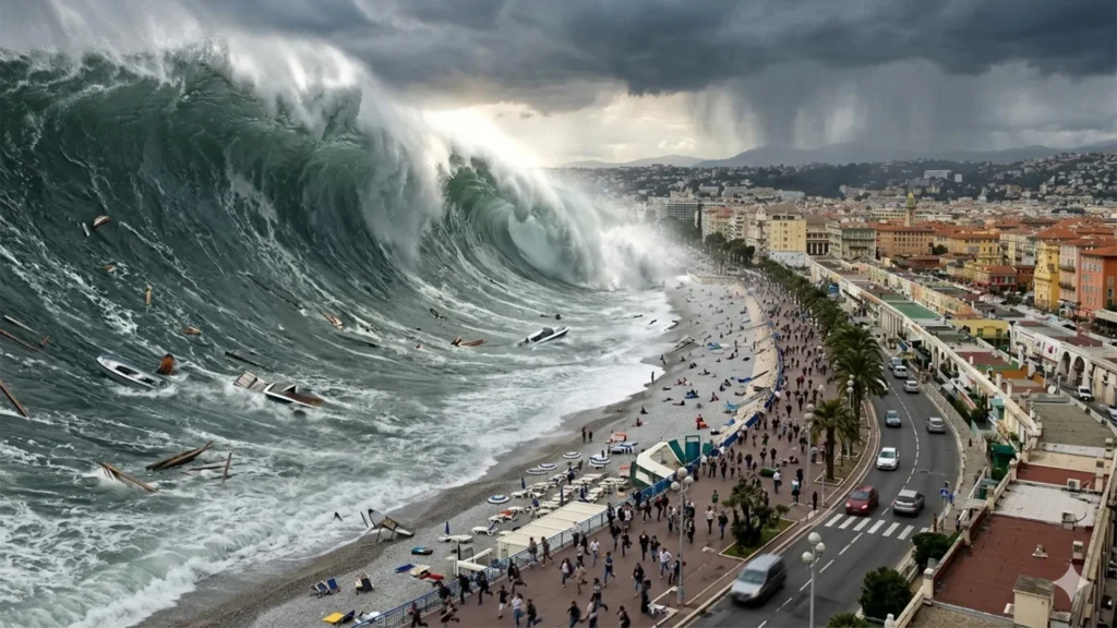
In the event of an underwater landslide or a nearby tectonic shift, the first waves could crash onto the beaches of the French Riviera in under ten minutes. France’s national tsunami warning center, Centre d’alerte aux tsunamis (Cenalt), is optimized for regional coordination, but its mandate to verify data and issue initial alerts to authorities within 15 minutes creates a perilous "information gap." In this window, the formal warning system—however sophisticated—cannot be the only line of defense.
This mathematical reality has forced a shift in strategy. Rather than relying solely on push notifications and sirens, local officials and researchers from the University of Montpellier are focusing on a proactive, "before-the-emergency" framework. They are mapping precise walking routes, designating vertical and horizontal refuge sites, and training the public to recognize the visceral warning signs of a tsunami, ensuring that the critical decision to evacuate is made by the individual long before the authorities can sound the alarm.
A History of Unseen Danger
While the Mediterranean is often viewed as a calm lake, UNESCO has aggressively challenged this complacency. On June 22, 2022, the organization released a stark assessment: the probability of a tsunami wave exceeding one meter in the Mediterranean over the next 30 years is nearly 100%.
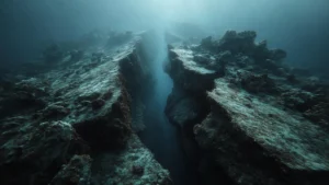
This is not a prophecy of a single, basin-wide catastrophe, but rather a statistical acknowledgment of the region’s volatile composition. The Mediterranean is a complex mosaic of fault lines. To the north, the Ligurian Sea hides active faults near the French and Italian coasts. To the south, the convergence of the African and Eurasian tectonic plates acts as a constant engine for seismic activity. Furthermore, the region’s steep underwater topography makes it highly susceptible to submarine landslides—events that can trigger localized, high-energy tsunamis that are notoriously difficult to predict.
Historical Precedents on the Riviera
The French Riviera is no stranger to these events. The Montpellier research team has documented roughly 20 significant tsunami events between the 16th century and the early 2000s, proving that the threat is not theoretical.
- 1887 Ligurian Earthquake: A magnitude 6.5–6.8 earthquake triggered a tsunami that caused the sea to retreat by a full meter in Antibes and Cannes, leaving fishing vessels stranded on the seabed before returning with waves nearly two meters high.
- 1979 Nice Landslide: A construction project for a new commercial port near the Nice airport collapsed, triggering a massive underwater landslide. The resulting tsunami claimed eight lives, with water reaching elevations of 3.5 meters and penetrating 150 meters inland.
- 2003 Boumerdès Earthquake: Originating in Algeria, this event demonstrated the reach of Mediterranean tsunamis. It took 75 minutes for the energy to cross the sea and strike the Riviera, causing significant damage to marina infrastructure and creating dangerous whirlpools and currents.
These events highlight the "harbor resonance" phenomenon, where the geometry of a bay or port can amplify the oscillation of water, causing disparate levels of damage in neighboring towns.
The Anatomy of the Threat
A common misconception is that a tsunami must look like a Hollywood-style "towering wall of water." In reality, a tsunami is often a rapid, relentless surge—a sudden rise or retreat of the sea that behaves less like a wave and more like a high-velocity, sustained flood.
The danger lies in the kinetic energy. Even a 50-centimeter surge can possess enough force to knock a person off their feet, while larger surges exert pressures equivalent to several tons per square meter, capable of compromising the structural integrity of coastal buildings. The first wave is frequently not the largest, and the "all-clear" signal can only be given after hours of monitoring.
Mapping the Path to Survival
The French government, in collaboration with the University of Montpellier, has established a rigorous evacuation framework. They have defined a "coastal evacuation zone"—typically land under five meters in elevation and within 200 meters of the shoreline (extending to 500 meters near river estuaries).
The scope of this challenge is immense. Along the French Mediterranean coast, including Corsica, this zone encompasses 187 towns and 164,000 year-round residents. During the peak of the tourist season, that number swells by an additional 835,000 people. In the Nice Côte d’Azur metropolitan area alone, researchers must account for up to 87,000 beachgoers at any given time.
To manage this, scientists have employed advanced algorithms to identify the fastest walking routes to safety. By analyzing slope gradients, potential physical obstacles, and human walking speeds, they have identified nearly 100 "refuge sites" that sit outside the reach of a modeled wave.
Official Responses and UNESCO Recognition
The formal acknowledgment of this threat culminated in June 2026, when the Nice Côte d’Azur metropolitan area was granted "Tsunami Ready" recognition by UNESCO. This status is not a mere badge; it is a stringent accreditation that requires communities to meet 12 indicators, including:
- Risk Assessment: Ongoing mapping of hazards and vulnerability.
- Preparedness: Clearly marked evacuation routes and public refuge sites.
- Emergency Response: A 24/7 capability to receive and broadcast warnings, such as the FR-Alert system for mobile devices.
Nice follows in the footsteps of Cannes, which achieved this status in early 2024, and Deshaies in Guadeloupe. These municipalities are setting a precedent for the rest of Europe. However, maps and signage are only as effective as the public’s willingness to use them.
Implications: A Shift in Public Responsibility
The core of the new strategy is to eliminate the "wait-and-see" mentality. Experience from the 2011 Japan tsunami proved that survivors were largely those who took immediate action upon sensing a tremor, rather than waiting for an official siren or radio announcement.
For the French Riviera, the guidance is clear and urgent:
- Natural Warnings: If you feel a strong earthquake or see the sea suddenly retreat, do not wait for an alert. Move inland and to higher ground immediately.
- The "Pedestrian-First" Rule: In a tsunami scenario, roads will quickly become congested. Leave your vehicle behind. Abandoning cars is a critical component of the new evacuation plans to prevent traffic gridlock.
- The "Stay Away" Rule: Do not approach the shore to watch the sea. The largest surges may follow the initial event, and dangerous currents can persist for hours.
The Mediterranean is changing, and our understanding of its risks must evolve with it. The work being done in Nice serves as a blueprint for coastal regions worldwide: recognizing that while we cannot prevent the forces of nature, we can fundamentally change the outcome of a disaster by preparing the individual to act long before the wave reaches the shore. Knowledge is not just power in this context—it is the ultimate survival mechanism.