In the vast, untamed wilderness of Quebec’s Côte-Nord region, a geological titan has been hiding in plain sight for 390 million years. What was once dismissed by preliminary surveys as a volcanic curiosity has now been identified as one of the most significant impact structures on the North American continent. The discovery of the Uhackatik crater—a 25-kilometer-wide scar on the Earth’s surface—did not originate in a high-tech laboratory or from the lens of a deep-space telescope, but from the inquisitive eyes of an amateur astronomer scanning satellite maps for a weekend getaway.
This revelation serves as a profound reminder that the history of our planet remains partially obscured, waiting for the intersection of modern satellite imagery and human intuition to bring it to light.
The Chronology of a Discovery
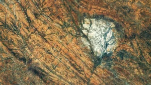
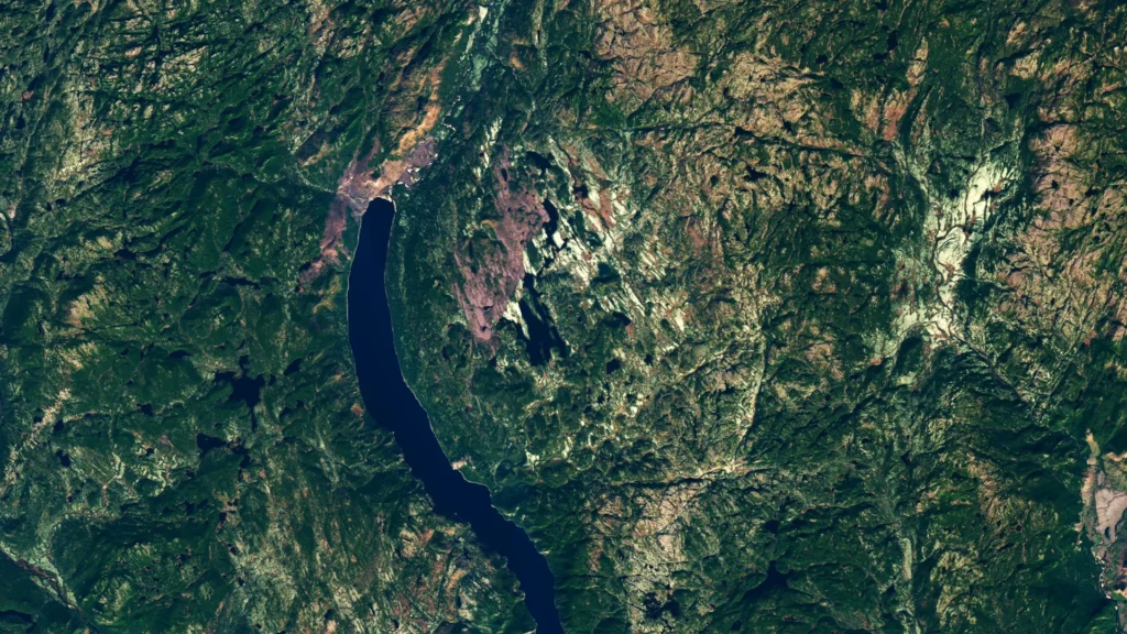
The story of Uhackatik began in 2024, when Joël Lapointe, an amateur astronomer with a penchant for exploration, began scouting the remote reaches of Quebec’s Côte-Nord via online satellite imagery. While planning a potential camping expedition, a peculiar, perfectly circular geological feature near Lake Marsal caught his attention. The symmetry of the landscape was too precise to be a natural tectonic accident, and his astronomical background prompted him to question if he was looking at the aftermath of a celestial collision.
Lapointe’s diligence led him to reach out to planetary science experts across North America and Europe. His inquiry acted as the spark that ignited a formal scientific investigation. By the time the Meteoritical Society held its 2024 annual meeting, a group of French researchers had already begun the process of cataloging the area as a potential candidate for an impact structure—the 11th such site identified in Quebec.
The possibility piqued the interest of Dr. Gordon Osinski, a preeminent planetary geologist at Western University and the director of the Impact Earth database. While initially skeptical—as many "potential" craters turn out to be volcanic or tectonic anomalies—Dr. Osinski determined the evidence warranted a physical expedition. In October 2025, a team of researchers ventured into the heart of the Quebec wilderness to verify the findings on the ground.
Navigating the Quebec Wilderness
The expedition to verify the Uhackatik crater was far from a standard geological survey. The remoteness of the region posed immediate logistical hurdles. The team arrived via floatplane, but the rugged, water-choked terrain prevented a direct landing on the shore. To access the site, the researchers were forced to wade through 50 meters (165 feet) of freezing, marshy water, hauling their scientific instrumentation through an environment that proved hostile to both equipment and personnel.
Once on land, the challenge intensified. Dr. Osinski, a veteran of fieldwork across six continents, described the environment as one of the most difficult he had ever navigated. The terrain was characterized by a dense, "gnarly" tangle of vegetation and swampy, uneven ground that obscured the geological record.
For years, local geological maps had incorrectly labeled the region as a "diatreme"—a volcanic pipe formed by explosive magma eruptions. This interpretation had been accepted for decades because the local breccia (broken rock fragments) bore a superficial resemblance to volcanic debris. However, the expedition team was not looking for volcanic evidence; they were hunting for the fingerprints of a meteor strike.
Shatter Cones: The Smoking Gun
By the second day of the expedition, the scientific consensus shifted dramatically. The team discovered "shatter cones" embedded in the rock outcrops. Shatter cones are rare, distinctively conical, radiating fracture patterns that form only when a shock wave of immense pressure passes through a rock—the kind of pressure generated exclusively by hypervelocity impacts.
"It’s the only unequivocal evidence of an impact event that you can see in the field with the naked eye," Dr. Osinski explained. The presence of these cones effectively debunked the volcanic theory, confirming that the circular basin near Lake Marsal was indeed the result of a catastrophic asteroid strike.
The scale of the impact was immense. Measuring 25 kilometers (16 miles) in diameter, the crater features a complex structure, including a central uplift—a common feature in large impacts where the earth "rebounds" after the initial compression—and high cliffs exhibiting distinct columnar jointing.
Scientific Implications and Planetary History
The formation of the Uhackatik crater is currently dated to approximately 390 million years ago, during the Devonian period. This timeframe is particularly interesting to geologists, as it predates by roughly 100 million years a known spike in Earth’s impact history. Some researchers believe this later period of increased bombardment was linked to a massive collision within the asteroid belt, which sent a surge of debris into the inner solar system. Uhackatik serves as a critical data point in understanding the frequency and intensity of these ancient celestial threats.
In consultation with the Innu Council of Ekuanitshit, the structure has been named "Uhackatik," honoring the Indigenous history of the land. It stands as the largest impact crater identified globally since the 31-kilometer Hiawatha structure was discovered under the Greenland ice sheet in 2018.
If an impact of this magnitude were to occur today, the results would be cataclysmic. Dr. Osinski noted that such an event would cause "regional devastation on a scale that would wipe out major cities and have global climate impacts," underscoring the vital importance of identifying and cataloging these ancient structures to better prepare for future asteroid trajectories.
Official Responses and Future Research
While the scientific community largely considers the impact origin of Uhackatik confirmed, the process of formal recognition by the Meteoritical Society remains ongoing, with a committee review expected in their next cycle.
Despite his role as a member of NASA’s first Artemis Geology Team and his extensive work training astronauts for lunar missions, Dr. Osinski does not anticipate that Uhackatik will be used for future astronaut training. The difficulty of accessing the site makes it impractical compared to other, more accessible impact sites, such as the Kameshtashtan (Mistastin Lake) crater in Labrador, which has previously served as a training ground for deep-space explorers.
Instead, the value of Uhackatik lies in its contribution to the global geological record and its testament to the power of citizen science.
The Role of Citizen Science in Planetary Defense
For Joël Lapointe, the journey from hobbyist observer to the catalyst for a major scientific discovery has been transformative. In interviews, he expressed his immense satisfaction at seeing his intuition validated by professional geologists, stating that he was "over the Moon" when the confirmation arrived. His story has become a rallying cry for amateur scientists everywhere.
"I encourage everyone to not ignore intuition or an observation, even if it isn’t part of your field of expertise," Lapointe told the media.
This collaborative model is exactly what modern space agencies are aiming to cultivate. With the sheer volume of satellite imagery now available to the public, the potential for "crowdsourcing" planetary discovery is higher than ever. NASA, in particular, has launched several initiatives to harness this public interest:
- The Daily Minor Planet Project: A citizen science initiative where volunteers scan imagery to identify moving objects, helping to track asteroids and comets that may pose a future risk to Earth.
- Impact Flash: A program that invites participants to observe the dark side of the Moon for the brief, high-energy flashes of light that occur when small meteoroids strike the lunar surface.
- The Exoasteroids Project: A more advanced initiative that allows volunteers to analyze light curves from distant star systems to search for evidence of asteroid belts orbiting other suns.
Conclusion: The Final Frontier is Under Our Feet
The discovery of the Uhackatik crater is more than just a footnote in a geology textbook. It is a bridge between the curiosity of an individual and the rigorous pursuit of scientific truth. By turning his eyes to the ground rather than the stars, Joël Lapointe uncovered a violent chapter of Earth’s history that had been buried for nearly 400 million years.
As technology continues to provide higher-resolution views of our planet’s surface, the number of "hidden" geological features will inevitably shrink. However, the success of the Uhackatik expedition reminds us that no matter how sophisticated our algorithms become, the human element—the ability to look at a pattern and ask, "Why is that there?"—remains our most potent tool for discovery. Whether in the remote woods of Quebec or the deep, dark reaches of the cosmos, the search for our planet’s history continues, one citizen scientist at a time.