For decades, the “Big One” has loomed over the Pacific Northwest as a singular, terrifying inevitability. The Cascadia Subduction Zone—a 600-mile-long fault line stretching from Northern Vancouver Island to Cape Mendocino, California—is capable of producing a magnitude 9.0 or greater earthquake. Such an event would trigger massive ground acceleration, localized tsunamis, and widespread liquefaction, effectively isolating the region.
However, new research published in the journal Geosphere suggests that the catastrophe we have long anticipated may be merely the opening act of a much larger, more devastating geological symphony. According to a landmark study, the Cascadia Subduction Zone and California’s San Andreas Fault may be seismically linked, creating the potential for a cascading sequence of disasters that could paralyze the entire U.S. West Coast.
The Tectonic Architecture of the Pacific Rim
To understand the gravity of this discovery, one must first visualize the complex "geological plumbing" of the American West. The western edge of the continent is defined by a volatile intersection of tectonic plates. North of Cape Mendocino, the Juan de Fuca plate is subducting—sliding slowly beneath the North American plate. This process creates the Cascadia megathrust, a region prone to massive, centuries-apart ruptures.
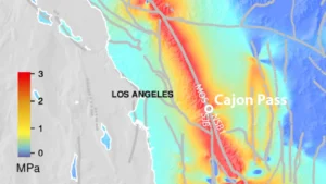
South of Cape Mendocino, the tectonic regime shifts. Here, the North American plate meets the Pacific plate at the San Andreas Fault, a transform boundary where the two plates slide laterally against each other. This is the source of iconic California earthquakes, such as the 1906 San Francisco disaster.
Historically, seismologists have treated these two systems as distinct entities. While they are neighbors, they function under different physical mechanisms. The revelation that they might act in concert—a concept previously relegated to the realm of disaster cinema—challenges the fundamental assumptions of West Coast earthquake hazard modeling.
A Serendipitous Error: How a Mistake Uncovered the Truth
The scientific breakthrough that linked these two giants was born of an unlikely mistake. In 1999, a team of researchers led by Dr. Chris Goldfinger, a prominent paleoseismologist at Oregon State University, embarked on a research cruise with the objective of cataloging ancient earthquake history along the Cascadia margin.
The plan was rigorous: extract deep-sea sediment cores to analyze "turbidites"—underwater landslides triggered by seismic shaking. However, on the first night of the expedition, a navigation error occurred. A graduate student entered an incorrect latitude, and the research vessel drifted approximately 90 kilometers south of its intended target. By the time the sun rose, the ship was no longer in the Cascadia zone; it was positioned near Noyo Canyon, off the coast of Fort Bragg, California.
"When I woke up, I was pretty hot," Dr. Goldfinger recalls. "But, once we were there, I thought, ‘well, let’s take a core here.’"
That decision would prove to be one of the most significant pivots in modern seismology. The core pulled from Noyo Canyon contained a 3,000-year history of seismic activity. When the team analyzed the sediment, they discovered something that defied their current models: "doublet" events. These were pairs of distinct, thick sediment layers that appeared to have been deposited almost simultaneously.
Chronology of the Discovery: Deciphering the Layers
The chronology of these events was revealed through meticulous radiocarbon dating of the sediment samples. Each "doublet" consisted of two parts: a fine-grained element and an overlying, coarse-grained sandy unit.
The researchers hypothesized that the fine-grained layer was the result of a massive, far-reaching Cascadia megathrust earthquake, which would have shaken the entire margin. The coarse-grained unit, however, suggested a more localized, high-energy event originating from the San Andreas Fault.
By comparing the Noyo Canyon samples to those collected further north in the Cascadia region, the scientists realized that the timing of these doublets was synchronized across the entire geographic range. The statistical probability of these events occurring coincidentally in such a tight temporal window was vanishingly low. The data suggested a chain reaction: a Cascadia rupture, followed shortly by a San Andreas rupture.
Supporting Data: The Mechanics of a Domino Effect
How could one fault trigger another hundreds of miles away? The theory lies in the concept of dynamic triggering. A magnitude 9 earthquake in Cascadia would release an astronomical amount of energy, creating seismic waves that would ripple through the Earth’s crust for an extended duration.
These waves, even when attenuated by distance, can be enough to push a fault that is already "locked and loaded"—nearing its breaking point—over the edge. This is known as "stress transfer." If the San Andreas Fault is already under immense tectonic pressure, the sudden jolt from a Cascadia event could act as the final catalyst, triggering a secondary rupture.
The "upside-down doublet" stratigraphy mentioned by Dr. Goldfinger provides the smoking gun. In some samples, the sediment patterns indicate that the two ruptures occurred within hours, or perhaps even minutes, of one another. The sheer proximity of these deposits in the geologic record leaves little room for other interpretations.
Official Responses and Scientific Skepticism
The implications of the Geosphere study have sent ripples through the geological community and emergency management circles. While the findings are compelling, they are also sobering.
Official agencies, such as the United States Geological Survey (USGS) and the California Governor’s Office of Emergency Services (Cal OES), have begun to incorporate the possibility of "multi-fault ruptures" into their updated hazard models. However, scientists caution that correlation does not definitively prove a causal chain reaction in every instance.
"We are dealing with geologic timescales, which makes precise temporal determination incredibly difficult," notes one independent seismologist. "While the evidence for linked events is stronger than ever, predicting the frequency or the absolute necessity of a San Andreas follow-up remains a work in progress."
Nevertheless, the paradigm shift is undeniable. For decades, emergency planning was based on "single-event" scenarios. The realization that a Cascadia earthquake could be the catalyst for a San Andreas event fundamentally alters the scale of the required response.
Implications for Public Safety and Infrastructure
If a dual-rupture event were to occur, the strain on emergency response systems would be unprecedented. Currently, emergency management protocols rely on the assumption that unaffected regions will be able to provide aid to the disaster zone. In a scenario where both the Pacific Northwest and Northern California are simultaneously incapacitated, mutual aid would be logistically impossible.
Key Risks Include:
- Infrastructure Overload: Communication networks, power grids, and transit arteries across three states (Washington, Oregon, and California) would be compromised, making it impossible to move heavy machinery or relief supplies.
- Resource Depletion: Medical supplies, food, and water would need to be distributed across an impossibly wide area, with no "safe zone" from which to launch operations.
- Economic Collapse: The combined damage to tech, shipping, and agricultural hubs in these regions would trigger a national—and likely global—economic crisis.
Dr. Goldfinger’s personal takeaway is perhaps the most haunting. Reflecting on his own roots in the Bay Area, he noted, "If I were in my hometown of Palo Alto, and Cascadia went off, I think I would drive east. There looks to me like a very high risk the San Andreas would go off next."
Conclusion: Preparing for the Unthinkable
The discovery of the Cascadia-San Andreas link serves as a stark reminder of the limits of our understanding regarding Earth’s crust. While we have mapped the surface of the planet with precision, the deep-seated forces that shape our landscape remain unpredictable.
The study serves as a call to action. It is not intended to incite panic, but rather to foster a more resilient approach to infrastructure. If the West Coast is to survive the "Big One," or the "Even Bigger One," that resilience must be built on the understanding that these faults do not exist in isolation. They are part of a singular, interconnected system—one that is currently ticking, and one that we must be far better prepared to face.