
The French Riviera is a landscape defined by its shimmering Mediterranean vistas, bustling harbors, and a tourism-dependent economy that draws millions to its golden beaches every year. Yet, beneath the tranquil surface of the Ligurian Sea, a quiet but persistent geological reality persists: the risk of a tsunami. Experts warn that for coastal residents and sunbathers, the margin for error is razor-thin. In some local scenarios, the initial surge of a tsunami could reach the shoreline in under ten minutes—a timeline that outpaces the current national alert infrastructure.
With France’s national warning center, Centre d’alerte aux tsunamis (Cenalt), typically requiring up to 15 minutes to verify data and transmit an initial alert to authorities, the gap between the onset of a disaster and official notification is nonexistent. To close this life-saving window, researchers and local officials are shifting from a strategy of reactive warning to one of proactive, pre-emptive survival.
The Mediterranean: An Unexpected Theater for Tsunami Risk
For decades, the Mediterranean has been viewed by the public as a "safe" basin, immune to the kind of catastrophic tsunamis seen in the Pacific or Indian Oceans. UNESCO, however, has spent recent years systematically dismantling this complacency. In a sobering 2022 advisory, the organization stated that the probability of a tsunami wave exceeding one meter in the Mediterranean within the next 30 years is close to 100%.
While this figure is a statistical projection for the entire Mediterranean basin through 2052—and not a specific forecast for a single beach—it underscores a reality often overlooked: the region is geologically volatile. The Mediterranean is home to active fault lines, particularly in the Ligurian Sea near the French and Italian coasts. Further south, the collision between the African and Eurasian tectonic plates acts as a secondary, high-energy engine for potentially destructive seismic events. When these factors are coupled with the risk of underwater landslides, which can trigger localized but powerful surges, the threat becomes localized and immediate.
The Myth of the "Wall of Water"
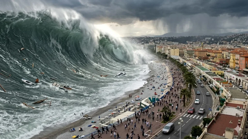
One of the greatest obstacles to public safety is the cinematic misconception of a tsunami as a towering, singular wall of water. In reality, a tsunami is a complex hydrodynamic event. It can manifest as a rapid, unnatural retreat of the sea, followed by a violent, surging flood, or simply a swift, relentless rise in water levels.
Even a "small" tsunami—with an amplitude of just 50 centimeters—can be lethal. Because of the massive volume of water involved, these waves behave more like a rushing, high-energy torrent than the rhythmic wash of ordinary surf. The initial wave is rarely the largest, and the sustained currents can exert forces equivalent to several tons per square meter, capable of destroying coastal infrastructure and trapping those who remain near the water.
A Chronology of Vulnerability: Historical Precedents
The French Riviera is not a stranger to these events. Researchers from the University of Montpellier have identified roughly 20 reported tsunami incidents along the coastline between the 16th century and the early 2000s, proving that the risk is historical, not hypothetical.
- 1887 Ligurian Sea Earthquake: On February 23, a magnitude 6.5–6.8 earthquake triggered a sea-level collapse in Antibes and Cannes. Fishing boats were left stranded on the seabed before being struck by incoming waves of nearly two meters.
- 1979 Nice Landslide: A catastrophic, man-made disaster occurred when part of a port construction site collapsed into the sea. The resulting landslide caused a localized tsunami that claimed eight lives, with water levels reaching 3.5 meters and flooding inland up to 150 meters.
- 2003 Boumerdès Earthquake: A reminder of the basin-wide connectivity of the threat, this Algerian earthquake sent waves reaching the Riviera 75 minutes later. The event caused swirling water and strong currents in eight marinas, highlighting how "harbor resonance"—the way a basin’s shape amplifies wave energy—can turn a distant tremor into a local crisis.
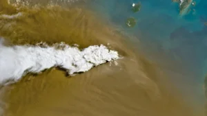
- 2022 Stromboli Eruption: A volcanic flow entering the sea near Stromboli triggered a small tsunami, serving as a modern-day reminder that seismic and volcanic activity remain constant threats to Mediterranean stability.
The Infrastructure of Alert and the "Last Mile" Problem
Since 2012, France has operated Cenalt to monitor seismic activity and communicate with UNESCO’s international warning network. When a potential tsunami is detected, the message is passed to the interdepartmental crisis management center (Cogic), which then triggers local emergency protocols, including the FR-Alert mobile phone notification system.
However, the "last mile" of this chain is the most vulnerable. If a tsunami is generated by a nearby landslide or an earthquake in the Ligurian Sea, the wave could hit the beach before a phone buzzes with a notification. Consequently, the strategy in Nice and surrounding areas is to decouple personal survival from the official alert system. Residents and tourists are being taught to recognize natural warning signs—such as an earthquake that makes it difficult to stand, or a sudden, rapid recession of the tide—as an immediate directive to evacuate.
Mapping Survival: Data-Driven Evacuation
To address this, the University of Montpellier’s Laboratory of Geography and Land Planning has pioneered a rigorous, data-driven approach to coastal safety. By analyzing population density, elevation, and terrain, they have established "evacuation zones" that encompass land below five meters in elevation and within 200 to 500 meters of the shoreline.
Across the French Mediterranean coast, this involves 187 towns and 164,000 year-round residents, a number that balloons to over 800,000 during the peak summer tourist season. To manage this, researchers have used computer modeling to design the most efficient walking routes to "refuge sites." These sites, nearly 100 of which have been validated by local authorities, are located beyond the reach of potential waves.
These routes are not mere lines on a map; they are optimized for human behavior, accounting for bottlenecks, slopes, and the physical constraints of large crowds. By creating an interactive platform, the city ensures that the public can familiarize themselves with these routes long before an emergency occurs.
Official Recognition and Global Implications
In June 2026, the Nice Côte d’Azur metropolitan area was officially recognized as "Tsunami Ready" by UNESCO. This status is the gold standard for disaster preparedness, requiring adherence to 12 strict indicators, including public education, 24/7 alert distribution, and validated emergency response plans.
Nice joins a select group of communities, including Cannes and Deshaies (Guadeloupe), that have taken the lead in institutionalizing tsunami safety. The success of these programs is rooted in scientific support from institutions like the University of Montpellier, which provide the technical framework for evacuation modeling.
The importance of this preparation cannot be overstated. Following the 2011 Japan tsunami, post-disaster studies showed a 96% survival rate in inundated areas—a figure largely attributed to robust, pre-existing education and evacuation drills. Japan’s experience serves as a sobering template: in a high-speed disaster, the difference between life and death is often a pre-planned route and the muscle memory to use it.
The Path Forward: Implications for Coastal Living
The overarching message from the French Riviera’s efforts is that while technology is essential, human agency is paramount. Officials stress that when an alert is issued, or when natural warning signs appear, individuals must abandon vehicles—which quickly become traps in the narrow streets of the Riviera—and move inland on foot.
The goal is a cultural shift. The Mediterranean, long viewed as a tranquil playground, must be respected as a dynamic environment capable of sudden, violent change. By prioritizing pre-emergency planning, identifying refuge sites, and fostering a culture of public awareness, the French Riviera is transforming from a vulnerable tourist destination into a model of coastal resilience.
As the climate changes and global disaster risks evolve, the lessons learned in Nice—where every minute is a battle against the clock—provide a blueprint for coastal communities worldwide. In the face of a tsunami, the most effective tool is not the siren that rings, but the decision that is made before the water begins to move.